Après plus d’un an de développement, MyTrails 2 est enfin prête à être mise dans toutes les main. Il y a tellement de nouveautés et de changements que le style habituel de release notes ne permet pas de les présenter, et presque toute les fonctionnalités ont été améliorées ou complètement refaites.
Voici un rapide tour du propriétaire!
Ravalement de façade
Des barres d’action et d’état transparentes, au menu de navigation latéral, en passant par le nouveau gestionnaire de traces, MyTrails a adopté les tout derniers éléments d’interface d’Android.

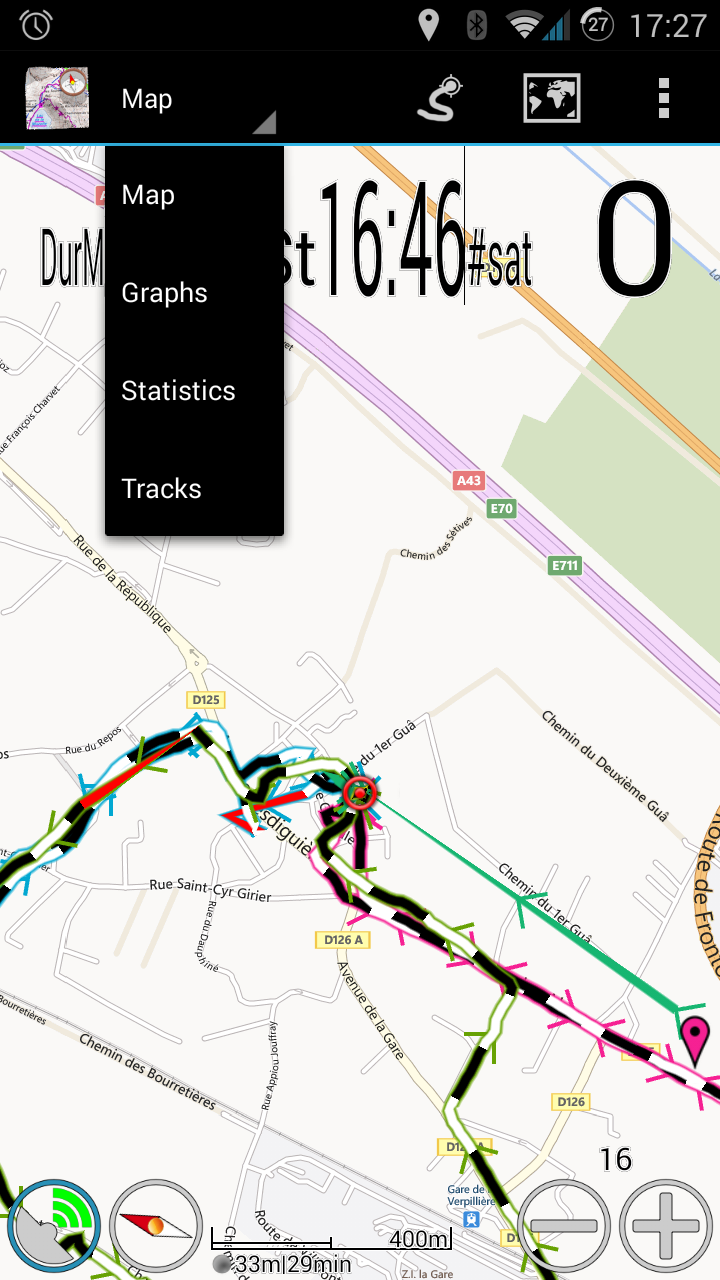
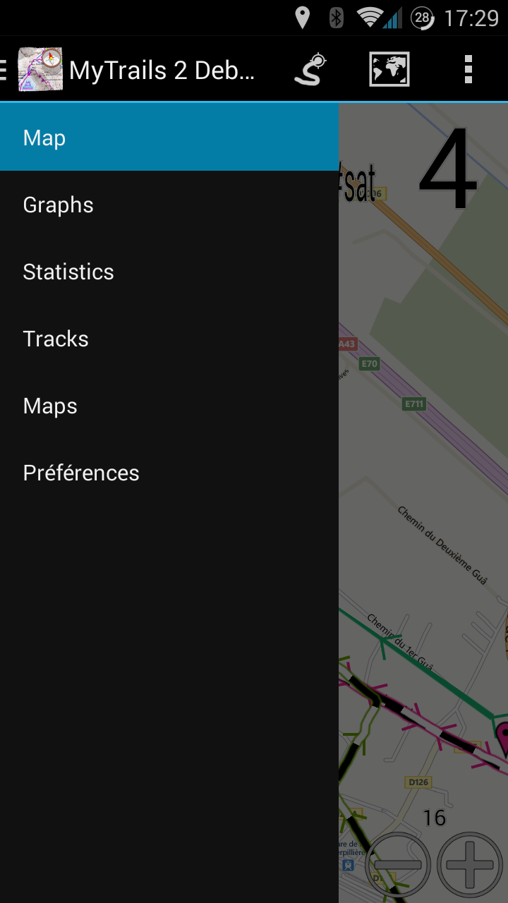
Le menu de navigation latéral: accès rapide à toutes les fonctionnalités
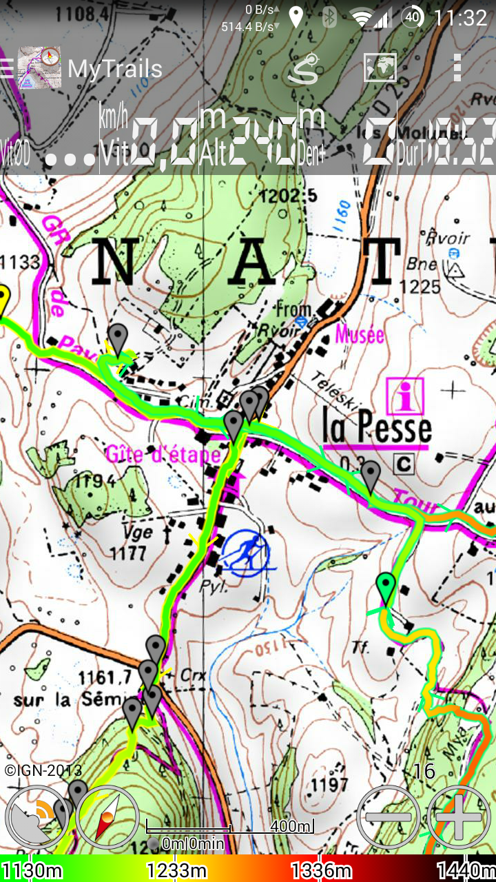
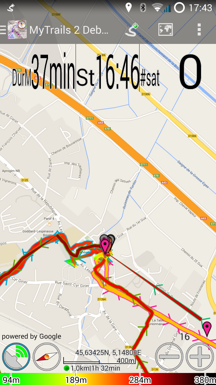
Les barres d’état, d’action et de navigation transparentes s’intègrent avec la carte
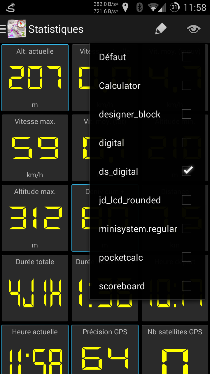
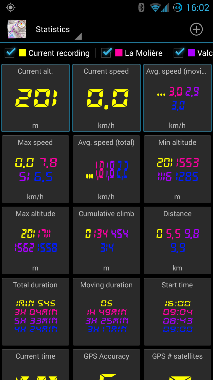
Statistiques
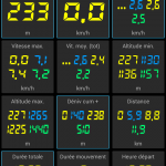
MyTrails est maintenant capable d’afficher en temps réel plus de 40 stats calculées à partir de vos traces enregistrées et de votre parcours. Grâce à des stats réclamées à cor et à cri comme le cumul de dénivelé ou de plus obscures comme la pente moyenne à la descente, vous pouvez quantifier de nombreux aspects de vos traces. Et ces stats peuvent être affichées pour plusieurs traces en même temps.
Vous pouvez sélectionner n’importe lesquels de ces indicateurs (jusqu’à 5) et les afficher sur le HUD présent sur la vue principale (sur la carte).
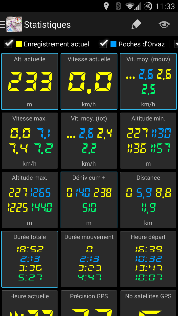
Créez votre propre tableau de bord
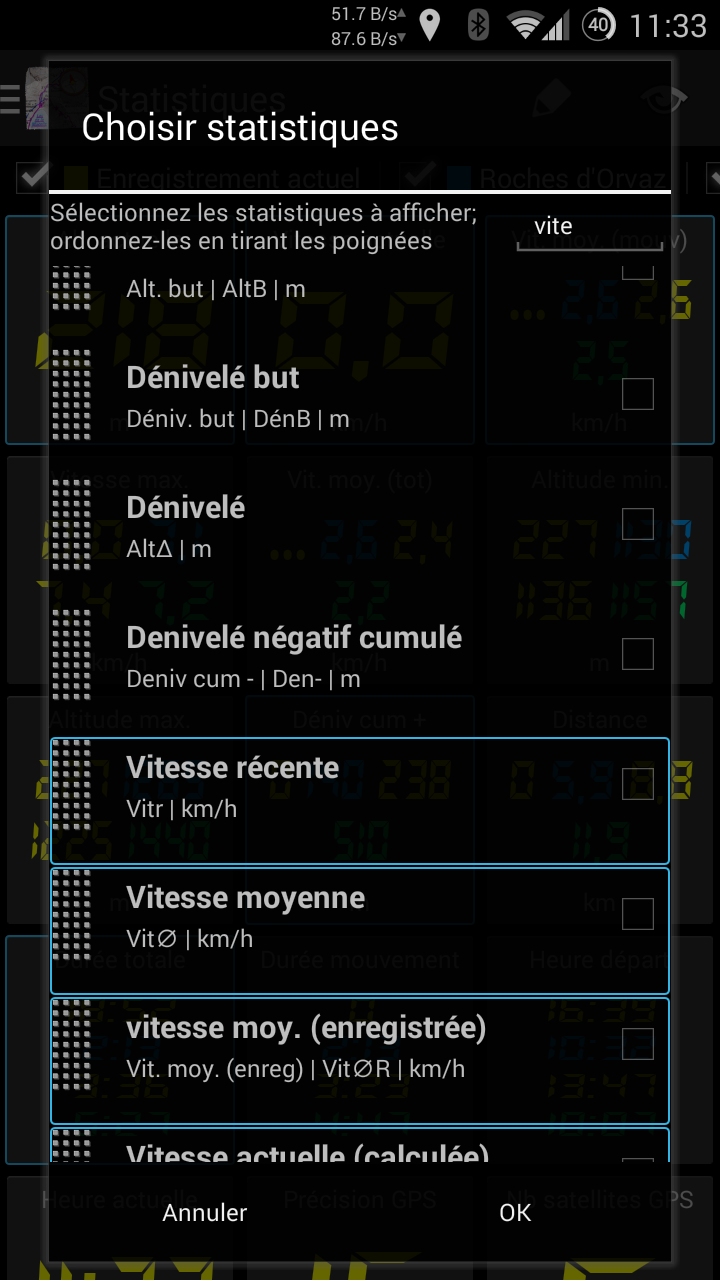
Plus de 40 indicateurs disponibles
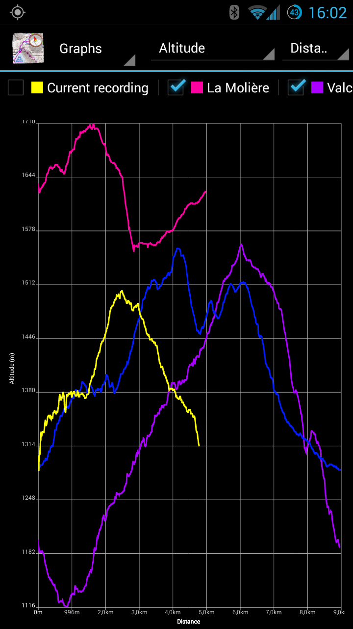
Graphiques
Les stats présentent une vue instantanée ou synthétique des traces, alors que les graphes vous donnent une indication précise de leur évolution au cours du temps. Et là aussi vous pouvez comparer vos traces enregistrées par rapport à votre parcours.
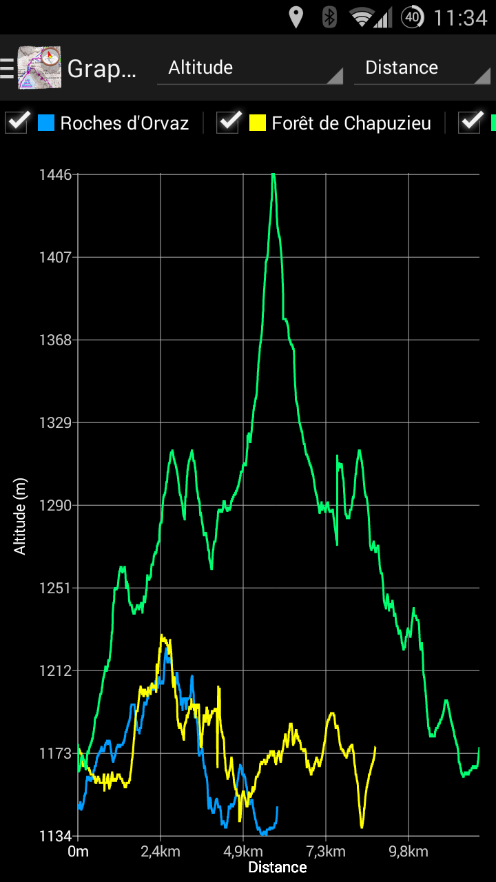
Sélectionnez librement les traces et les axes
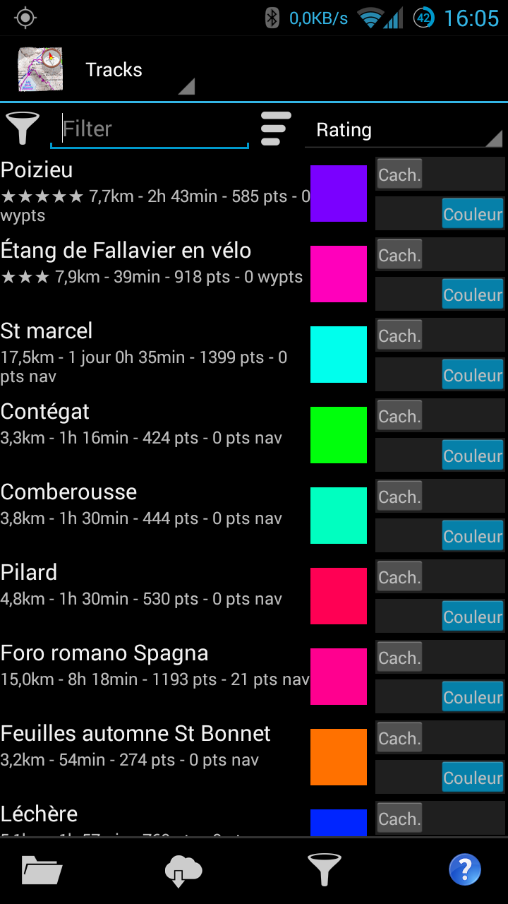
Gestionnaire de traces
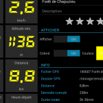
Le nouveau gestionnaire de traces simplifie la visualisation de vos traces sans qu’il soit nécessaire de les afficher sur la vue principale: informations générales de la trace, stats et graphes, et même le contour de la trace sont à porté de la main. Pour une ou plusieurs traces à la fois.
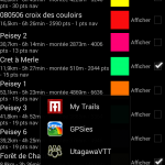
Récupérez, partagez, envoyez plusieurs traces simultanément, bien d’autres fonctionnalités !
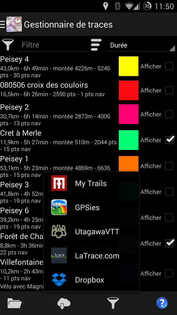
Organisez vos traces, récupérez-en de nouvelles
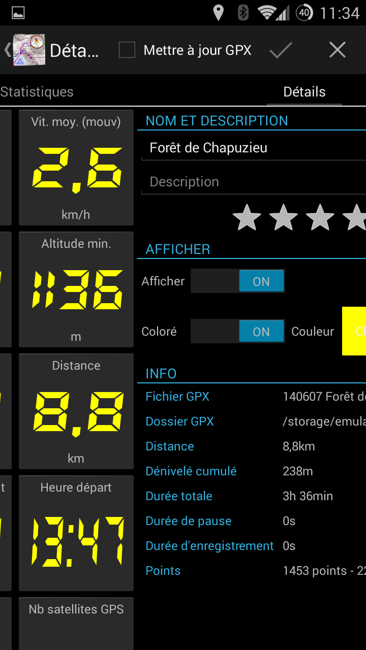
Une vue de la trace en 4 panneaux: graphes, stats, paramètres et carte
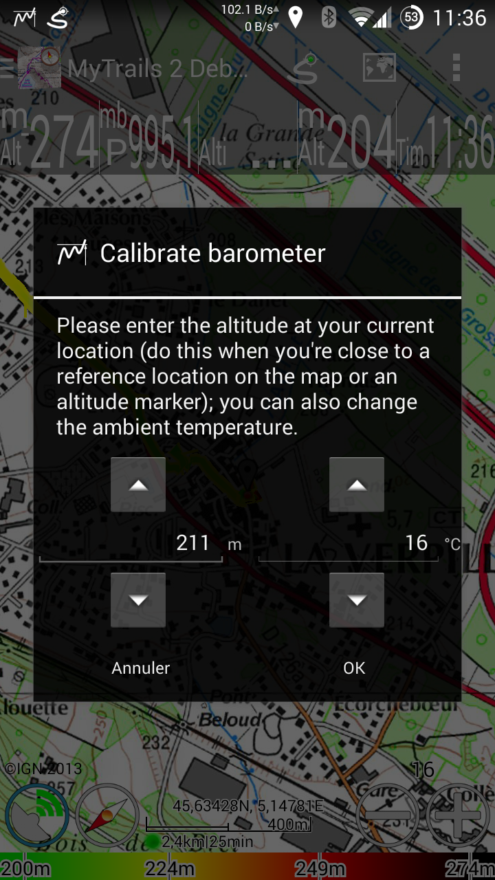
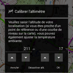
Altimètre
MyTrails peut maintenant utiliser le capteur de pression atmosphérique de votre téléphone, qui est en général plus précis que les informations d’altitude fournies par le GPS. Pour les meilleurs résultats possibles vous pouvez le calibrer manuellement, ou laisser faire MyTrails automatiquement.
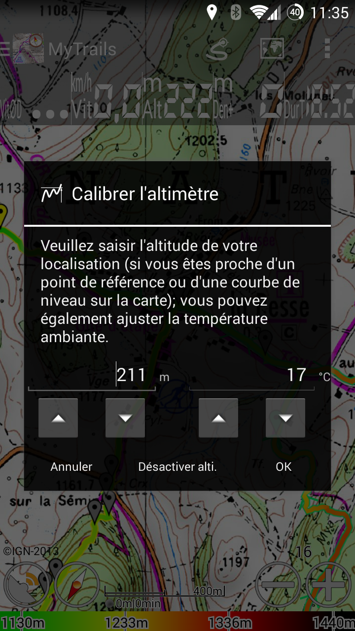
Calibration manuelle ou automatique
Version minimum
Un des principes de MyTrails a toujours été de fournir de bonnes performances même sur des terminaux limités, ce qui m’a jusqu’à présent conduit à conserver une compatibilité avec d’anciennes version d’Android. MyTrails 2 ne fonctionne que sur Android 2.3 et plus récents.
Je continuerai à mettre à jour MyTrails 1.4 occasionnellement pour rester compatible avec les serveurs de cartes et corriger des bugs, mais les nouvelles fonctionnalités ne seront disponibles que sur MyTrails 2.
Écrans
-
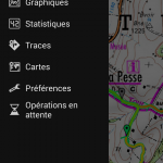
- Le menu de navigation latéral: accès rapide à toutes les fonctionnalités
-

- Les barres d’état, d’action et de navigation transparentes s’intègrent avec la carte
-
- Créez votre propre tableau de bord
-

- Plus de 40 indicateurs disponibles
-

- Sélectionnez librement les traces et les axes
-
- Organisez vos traces, récupérez-en de nouvelles
-
- Une vue de la trace en 4 panneaux: graphes, stats, paramètres et carte
-
- Calibration manuelle ou automatique