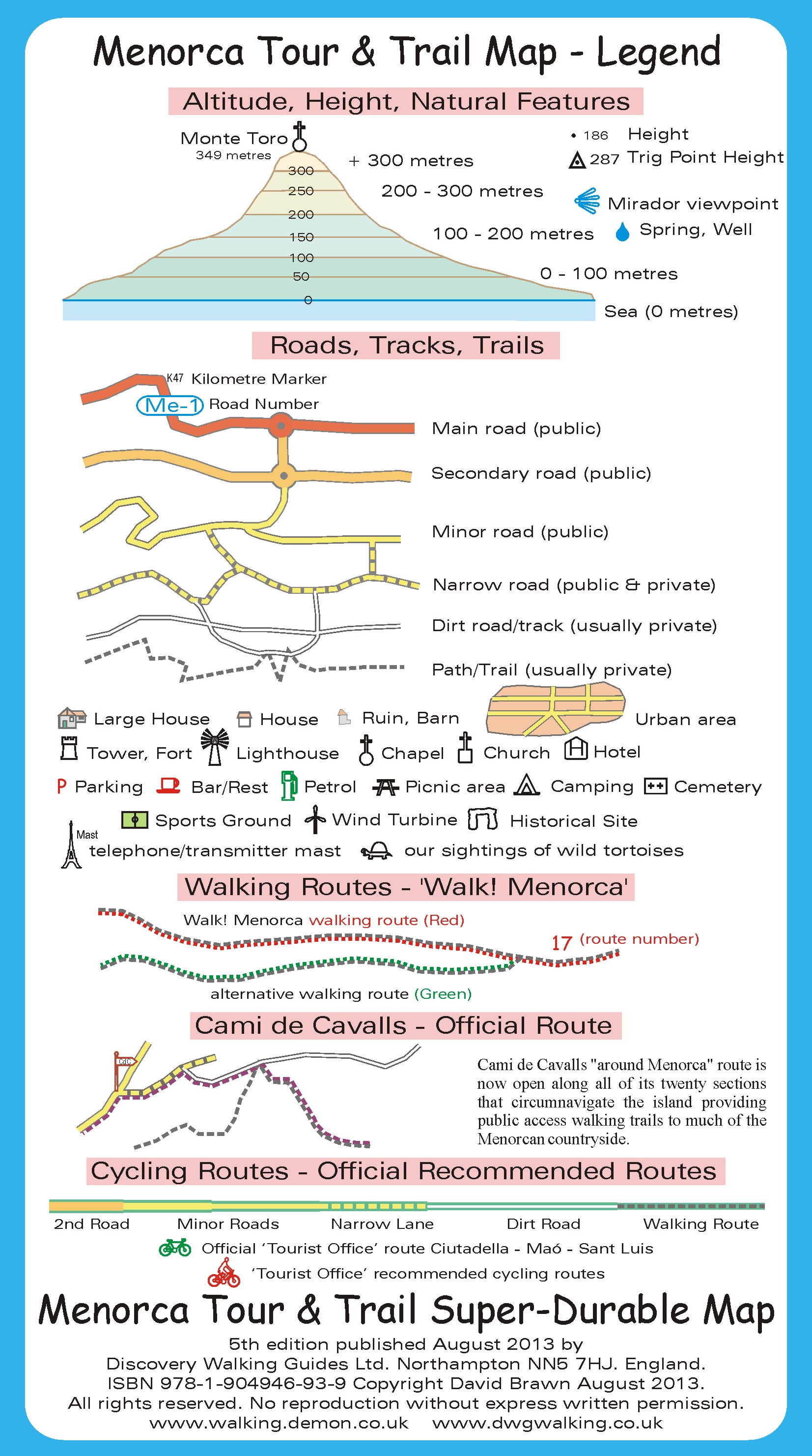
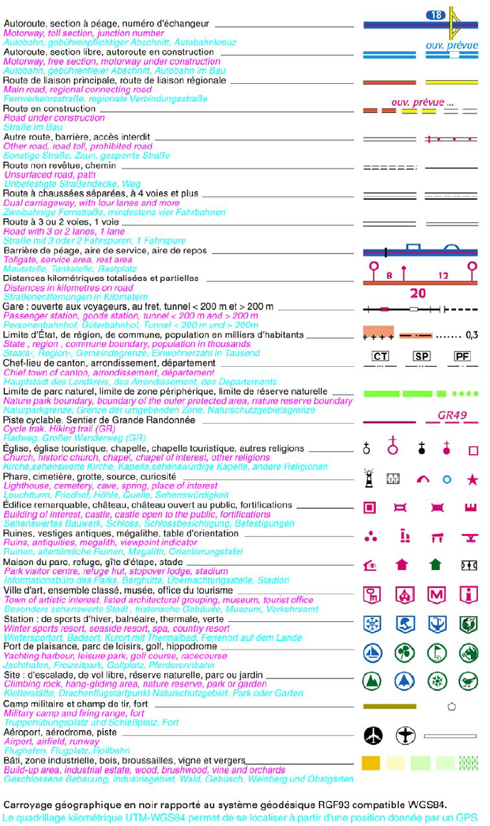
This legend (despite the mention of Menorca) is valid for all Tour & Trail maps.
Top 25
Top 100
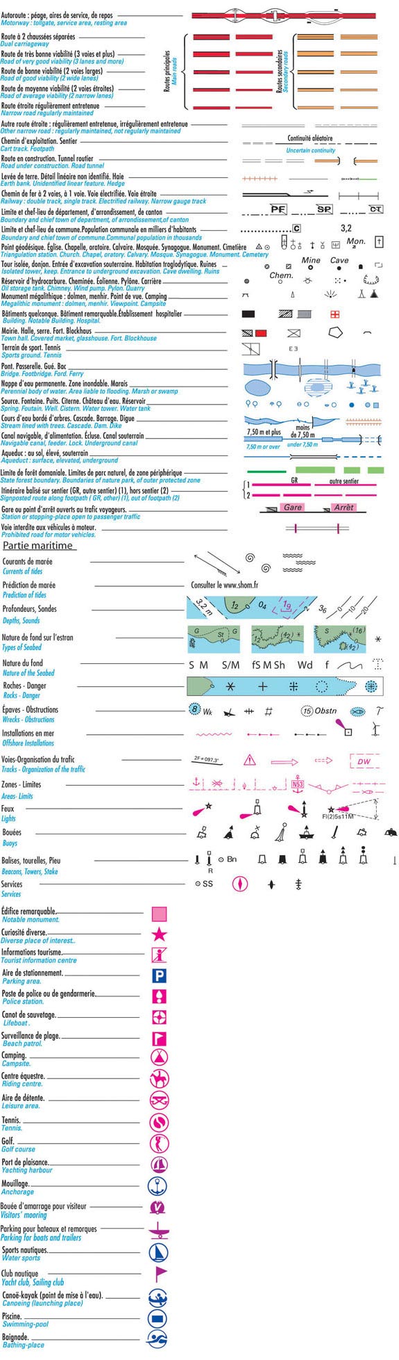
More info on this IGN document (French).
[post_list preset=”versions_all”]
[post_list preset=”manual_all”]