Following an update of the Dropbox API, some features are currently unavailable. In particular, connecting a new device to Dropbox doesn’t work.
I hope to release a new version shortly to resolve.

Following an update of the Dropbox API, some features are currently unavailable. In particular, connecting a new device to Dropbox doesn’t work.
I hope to release a new version shortly to resolve.
As Google continues to make it harder for applications to share data, you may have to move your offline maps and GPX save location to a MyTrails-specific folder rather than the traditional /sdcard/MyTrails.
Several users have reported that using a folder like android/media/com.frogsparks.mytrails (inside the main device storage, presumably also on a removable storage) works.
If you’re not using offline maps (only GPX saved tracks), you can probably stick with your usual save location, but you need to switch to the standard Android file picker (disable Use internal file picker in MyTrails > Preferences > Other).
For more general info, see this older post.
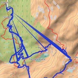
On some devices, MyTrails draws recorded tracks with lines leading back to the start of the recording. This is only a display issue, and the lines change when you zoom in or out.
For the moment, to fix this, use the toggle track mode hidden option to select the Lines mode.
If this doesn’t fix the problem, you can use the same hidden option to get back to Smooth triangles, and check that the problem is not with the recording itself.
The map1.eu servers are currently online offline.
This has happened in the past, and the server eventually came back, but there is no certainty it will be the case this time.
This server has alternated between online and offline in past weeks, and is increasingly unreliable.
At the moment the Kompass map is no longer working. I will attempt to find a way to get it to work again, but it’s entirely possible that won’t be successful.
As with all free maps, I can’t make any guarantees that a given map will remain available, as the map owners may stop providing it or start protecting it effectively.
The owner of GPSies sold their web site to AllTrails, which subsequently closed the APIs that MyTrails was using to upload and download tracks. I will remove the integration in a later version of MyTrails, but for now MyTrails will just display an error when you try to use GPSies.
I’m assured that MyTrails.com.au is still operational and has no plans to shut down or sell out. Feel free to use it for all your track sharing needs (uploading and downloading).
(note that despite the fact that My Trails the web site and MyTrails the app share a name and a good working relationship, they are operated independently – if you need support for the app, use mytrails.app; if you need support for the site, use mytrails.com.au)
OpenStreetMaps recently changed their server infrastructure to better handle the load. This had the side-affect of breaking all OSM-based maps in MyTrails because they now require a specific per-app User-Agent HTTP header.
Unfortunately MyTrails didn’t support directly editing the HTTP header so fixing the maps required updating the app.
The maps should be updated when you launch MyTrails after the update, unless you already changed an affected map, in which case MyTrails will create a fixed copy at the end of the list.
Due to a cascade of unfortunate issues with the server hosting the forum.mytrails.app service, I have lost the server and its data.
It’s inconvenient for me, but to those of you who contributed to the forum, it’s a loss of the time you invested in it, and for that I am deeply sorry.
Sadly, it is representative of a lack of time on my part to adequately maintain MyTrails itself and the infrastructure that underpins it. Which leads me to the painful of decision having to sunset MyTrails…
I started MyTrails over ten years ago, before Android was even released. The Android version itself was started in late summer 2010, almost ten years ago.


In that timespan, Android has gone from clunky keyboard and d-pad phones with weak CPUs and little RAM to all-screen slabs with more RAM than some desktops and blazing CPUs.
When I started MyTrails, the few map apps that existed were slow and laggy because they relied on Android’s then-basic image display technologies to draw map tiles. One of MyTrails’ signature features was that, because it used OpenGL to render images, it was fast even on low-end hardware.
Since then, phones have improved, and other apps (most notably Google Maps) have caught up to MyTrails’ use of OpenGL and stopped using pre-rendered maps altogether, switching to more efficient all-vector data.
Meanwhile, MyTrails went through other technological changes as Android refined its early rough edges and geekish looks, but the application stayed true to its roots: technical, a bit overstuffed with features and sometimes hard to use. And it skipped the white UI fad that Apple spearheaded, followed by Google, and which is finally over now that the latest versions of both systems offers a standard dark-mode.
From a personal standpoint, MyTrails started as a fun hobby (and a way to not get lost while hiking), became my main occupation and revenue stream for a few years, and returned to a hobby as I was unable to make it stand out enough in a crowded market for it to remain my sole revenue stream.
During that time I released over a hundred updates, MyTrails was downloaded over 1.5M times and was used by about 200k users at its peak in 2017. It has also helped me become a full-time developer once more, and the expertise I gained developing and publishing it has allowed me to become a minor expert in Android development and to help found a successful development studio.
So what does it mean for MyTrails?
Basically, not much for now, since I wasn’t actively developing new features. However, I will not be rebuilding the forum, and will prioritize resolving subscription issues over answering questions about bugs and feature requests.
I will continue to update the New maps page to help update built-in maps and make it easier to use new and fun maps that may come to my attention.
I have spent most of my spare time in 2019 dealing with obsolescence driven by Google: shutting down G+, making their geo APIs paid, transitioning from Fabric to Firebase, changing push notifications from Google to Firebase, forcing developers to target the latest APIs, etc.
But Android 11 is just around the corner, and Google will continue to make it harder to store files on our devices, taking Android further down the path of a locked-down iOS-style experience, but lacking its integrated ecosystem. This will make it even harder for MyTrails to support offline maps, since the API that Google wants developers to use (yet it won’t fully support in its own services, like Drive) is too limiting. So expect offline maps to no longer work if you update to Android 11, like some many other useful hacks and customization features.
Aside from offline maps, nothing much should change… but if it does, I may not be able to fix it, so maybe you shouldn’t count on MyTrails too much.
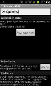
I want to thank early users who helped me shape MyTrails, my partners (OS Opendata, My Trails the track sharing site, VTTrack, Utagawa…), and the team of translators who translated the app to 10 languages (and partially to many more), and all of my dear users. I hope you continue to have fun hiking, skiing, mountain biking, riding, and more (hopefully most of you are environmentally conscious and try to limit your CO2 footprint).
Anyway, back to hiking!