
- Fixed Google Earth
- Removed Yahoo (the old Yahoo tiles are no longer available and the new service uses a protected HERE API)
- Optimization and fixes for map tile display
- Fixed inability to create offline OS25k-only maps
- Fixes and optimizations for WMS maps
- New option to hide automatic waypoints (pause and altimeter)
- Added support for using voice search: “Ok Google, search for Paris using MyTrails” (English-only until Google starts to support other languages)
Category Archives: Version history
2.0.4 & 2.0.5
- Define offline maps from maps.frogsparks.com/define_map.jsp so you don’t have to fiddle on your phone
- Send as SMS works with Hangouts
- Fixes for offline and WMS maps
- Many small fixes and adjustments
- 2.0.5: default language and missing voice data dialog fixed
2.0.3
- New track sharing community: RandoGPS (French focused)
- Added option to search for location in OSM and IGN (French, requires online subscription)
- Easy way to retry failed purchases (in Preferences > About > Retry purchase)
- Bug fixes
2.0.1-2.0.2
- Android Wear support!
- Android L adjustments
- Bug fixes (in particular, problem in Preferences on Gingerbread)
- More options for flexible URL map definitions
Note: 2.0.1 was only published to the beta channel.
2.0.0
After over a year of development, MyTrails 2 is finally ready for general release. There are a lot more changes than can be documented in the normal style of release notes, and most areas of MyTrails have been upgraded or are completely new.
Updated look
From the transparent action and status bars, to the slide-out navigation menu, to the new track manager, MyTrails uses the latest in Android interface elements.
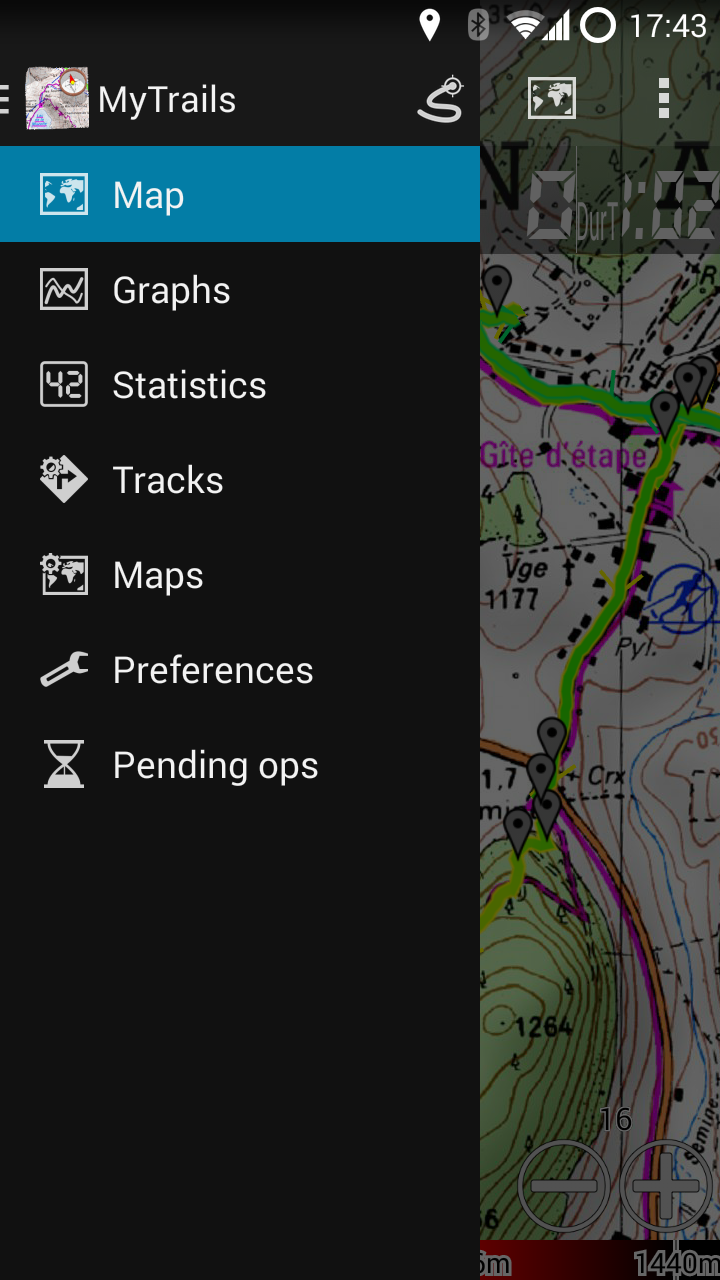
The slide-out navigation menu: quick access to all features

Transparent status, action and nav bars blend seamlessly into the map
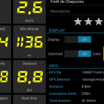
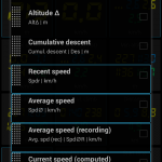
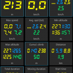
Stats
MyTrails is now able to display in real-time more than 40 stats about your saved tracks and the current recording. From much-requested stats like cumulative climb to obscure ones like average slope during a descent, you can quantify many aspects of your tracks. And these stats can be displayed for multiple recordings in parallel.
You can select any of these stats (up to 5) to display in the HUD on the main map view.
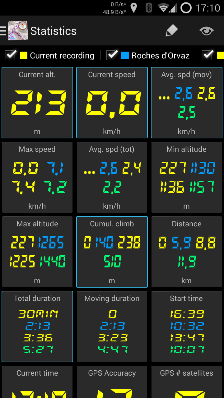
Create your own dashboard
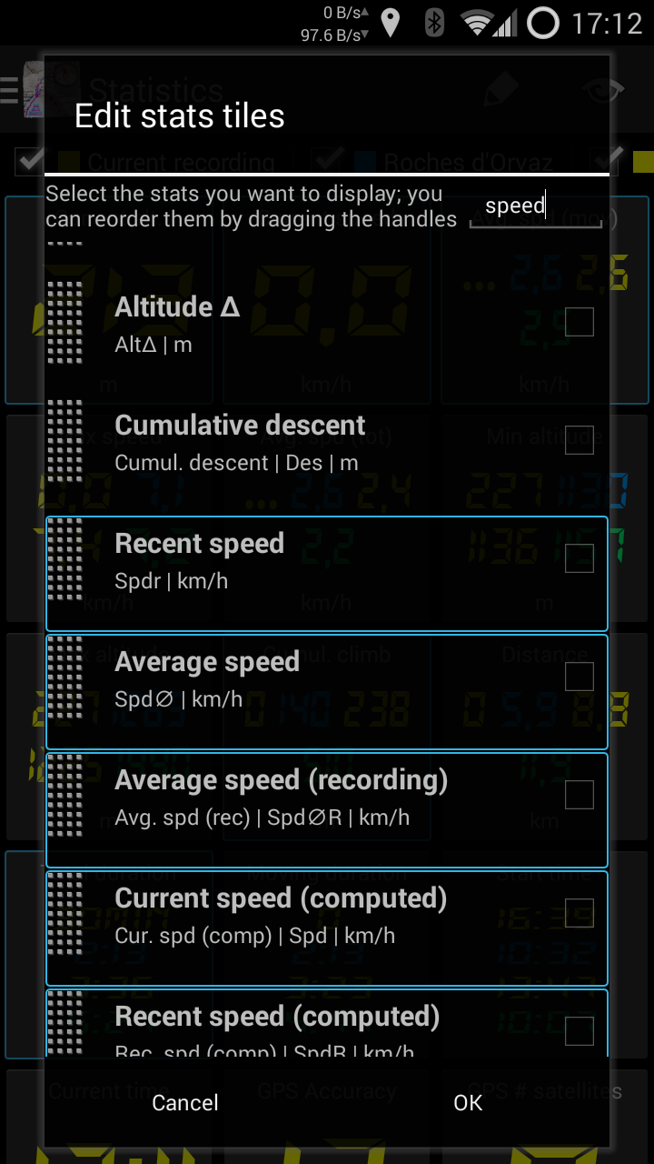
Over 40 available metrics
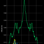
Graphs
While stats provide a synthetic view of many variables, graphs give you a better view of how these variables evolve over time. And again, you can compare saved tracks against your current recording.
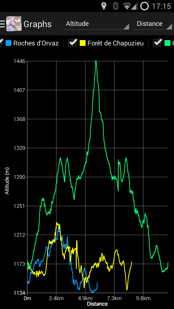
Select the tracks and axes freely
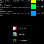
Track manager
The new track manager makes it easier to visualize your tracks without necessarily activating them: view general information, stats and graphs, and even the shape of the track, or multiple selected tracks.
Download, share, upload multiple tracks at once, and much more!
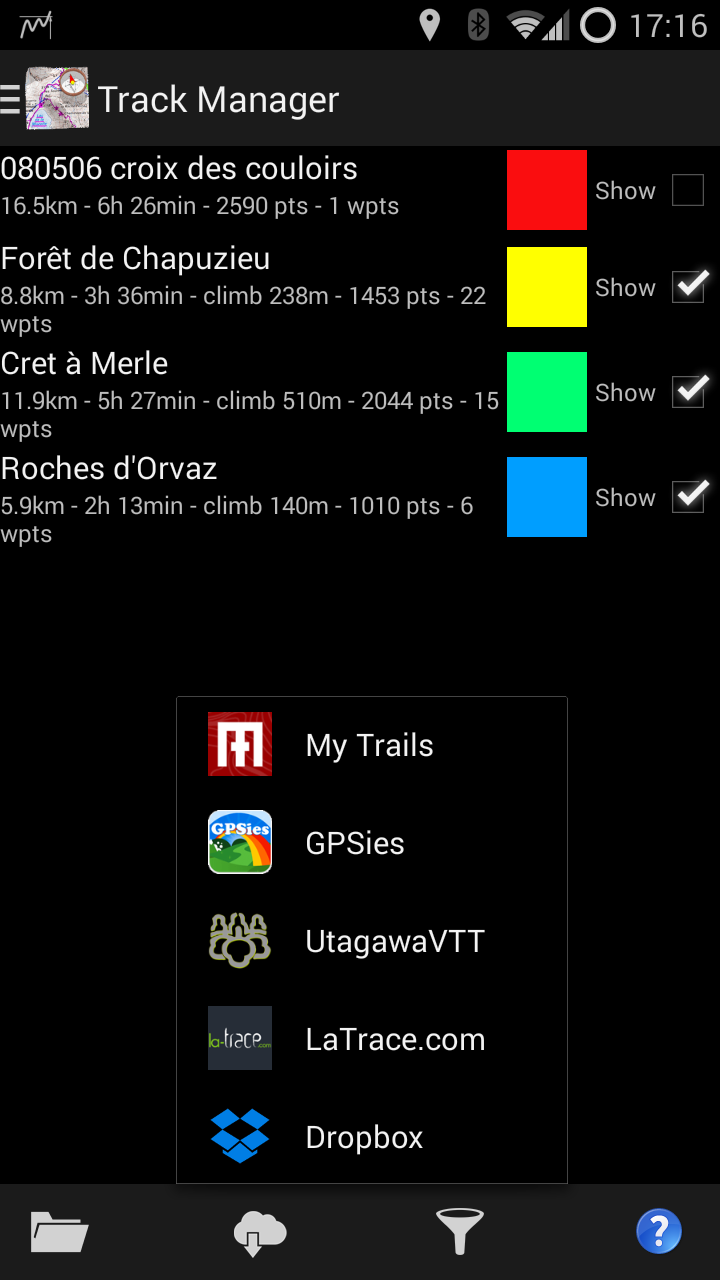
Organize your tracks, upload, download, etc.
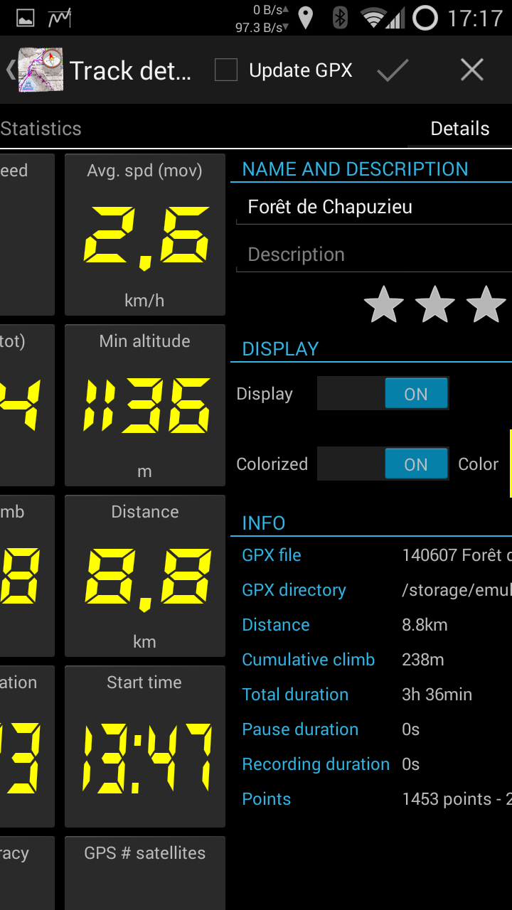
A 4-pane view of the track’s graph, stats, properties and map
Altimeter
MyTrails can now use your device’s pressure sensor, which can be much more accurate than the altitude provided by the GPS. For the most accurate results, you can calibrate it manually, or just let MyTrails auto-calibrate.
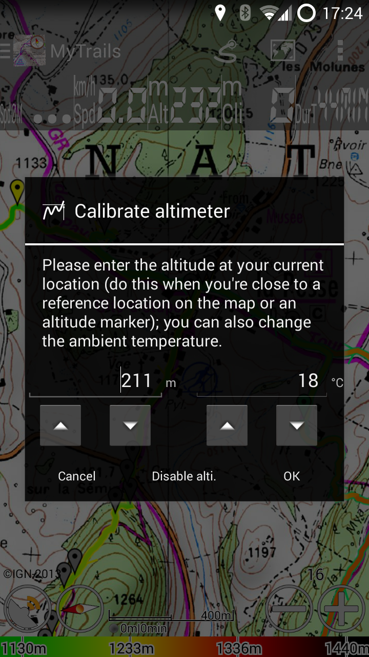
Manual or automatic calibration
Minimum version
Since one of the principles of MyTrails has been to provide good performance even on basic hardware, I have supported old versions of Android for a lot longer than I should have. MyTrails 2 only supports Android 2.3 and later.
I will continue to update MyTrails 1.4 occasionally for bug-fixes and map compatibility, but all new features will only be available in MyTrails 2.
Gallery
-
- Transparent status, action and nav bars blend seamlessly into the map
-
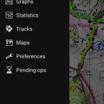
- The slide-out navigation menu: quick access to all features
-
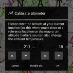
- Manual or automatic calibration
-
- A 4-pane view of the track’s graph, stats, properties and map
-
- Organize your tracks, upload, download, etc.
-
- Select the tracks and axes freely
-
- Over 40 available metrics
-
- Create your own dashboard
1.4.7
- Updated Mapquest map
- Force MyTrails to quit in a timely manner, even if Android wants to wait a bit
- Removed halo around outlines (in HUD, scale, etc.)
- Slight increase in map rendering speed
1.4.6
- Updated API to invoke MyTrails Contacts
- Fixed occasional flickering of tiles loaded from the network
- Fixed GPSies upload for some tracks
- License checking is more tolerant of network failure
- Added two options: Fallback distance calculation and Don’t warn of GPS errors, that were previously hidden options
1.4.5
- My sincere apologies to users who had trouble activating the App of the Day promotion; if you haven’t yet activated the promotion, this version should do it for you automatically
- You can now follow us on Facebook
- Fixed reported errors
1.4.4
- Fixed startup crash on Android 2.2
- Improved compatibility with some WMS servers
1.4.3
- Improved track drawing
- Fixed total recording time calculation
- Improved time and distance colorizations (dashed): when the recording quality is insufficient or map zoomed out too far, the colorization is disabled
- Support creation of extremely large offline maps (‘toggle bigger mgm’ hidden option)
- Easier waypoint selection: tap the point or body